Bike Brevard Map

How to use the apps

Six steps to your first ride

Bike Brevard Map and Bike Brevard Kids work the same way, so these steps cover both. The pictures are from Bike Brevard Map.
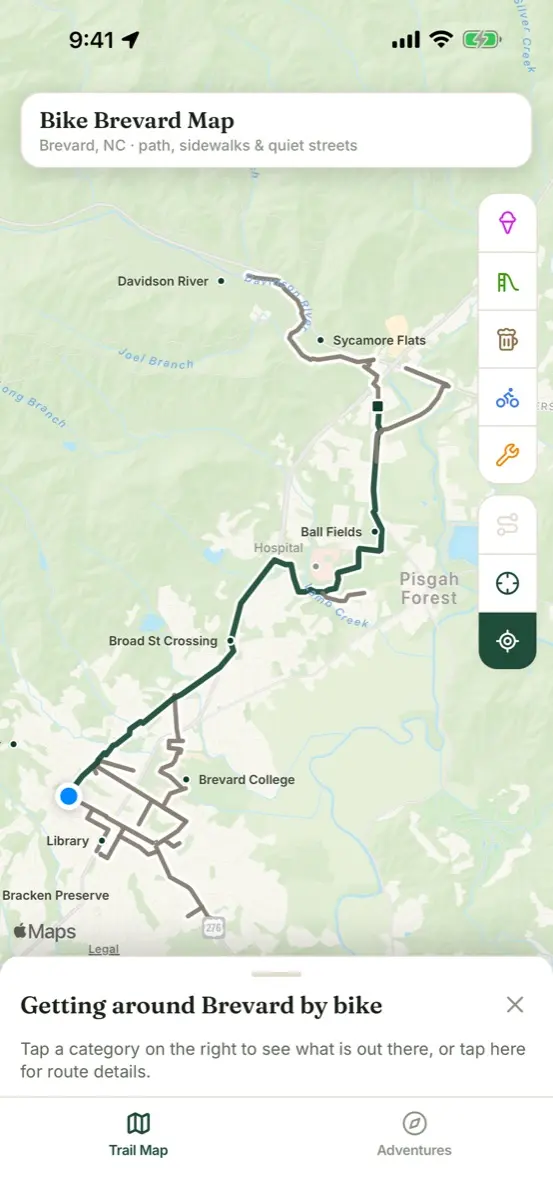
  1. The trail map with the path and connectors drawn over Brevard

    1Open the Trail Map

    • The green line is the paved path. Gray lines are connectors: sidewalks, quiet streets and greenways that join it.
    • The first card explains the map. Tap it for route details and trailheads, or put it away with the ×.
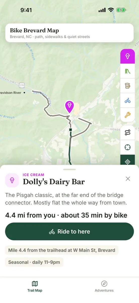
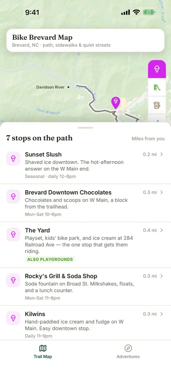
  2. Ice cream pins along the path

    2Switch on what you’re after

    • Tap a category on the right edge of the screen, and its pins appear on the map.
    • The list sits at the bottom. Tap it or slide it up to read every stop, ordered by mile.
    • Tap the category again to switch it off.
  3. A place card with its distance and a Ride to here button

    3Open a place

    • Tap a pin or a row in the list.
    • The card says what the place is, its mile marker and its hours, and whether the way there suits small kids.
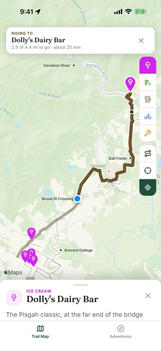
  4. The way to a place drawn along the path

    4Ride to here

    • Tap Ride to here on the card. It needs your location, and the app asks first.
    • The way is drawn along the path and connectors, with how far it is and about how long it takes by bike.
    • This is a drawn way with miles to go, not turn-by-turn directions, so keep your eyes on the path.
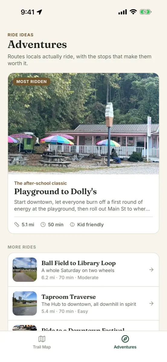
  5. The Adventures tab listing curated rides

    5Pick an Adventure

    • Tap the Adventures tab at the bottom for rides locals actually do.
    • Each ride has its distance, rolling time, effort, how it goes with kids, and its stops.
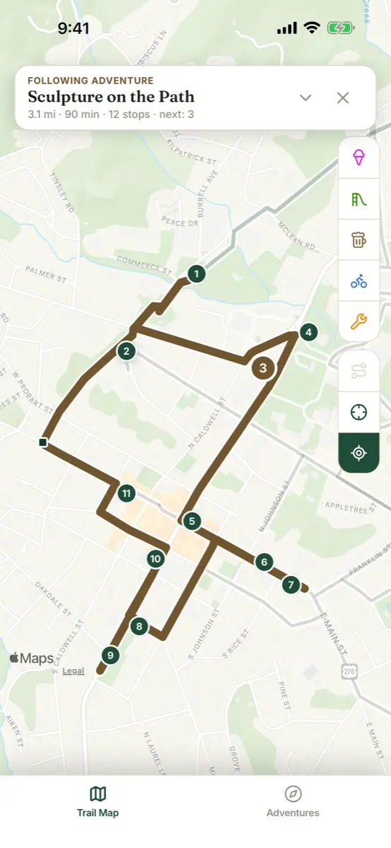
  6. A ride drawn on the map with numbered stops

    6Show route on map

    • Tap Show route on map to draw the whole ride with numbered stops.
    • Tap a number to read that stop’s note, and step through the stops from the bottom card.
    • With location on, the next stop is marked as you ride.

The buttons on the right

Three handy tools

Just the path
Hides every pin, so only the path and its links show.
Whole trail
Takes the map back to the whole trail.
My location
Shows where you are. It's optional, and your location is never saved or sent.

Two apps

What's different in each

Bike Brevard Map

On the App Store now, for iPhone

  • Categories: ice cream, playgrounds, breweries, bike shops and repair stations
  • Rides to try: Playground to Dolly's, Gateway to Pisgah, the Taproom Traverse

Download on the App Store

Bike Brevard Kids

Coming soon

  • Categories: ice cream, playgrounds, schools, after school, fun stops, bike shops and repair stations. No breweries or taprooms.
  • Rides to try: Bike to School Day, the ride to the rock gym for open climb
  • A few rides are marked "With kids: Adults", for when the grown-ups ride alone. Check that line on a ride before you take the kids.

Good to know, in both apps

No account and no sign-up. The whole map is in the download, so it works with no signal. Not every place sits right on the path, so take your time and follow general safety rules.

Stuck, or spotted something wrong? Send a support request.